The Mile Square

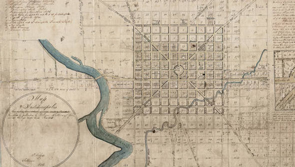
The history of city planning in Indianapolis began in 1821 with the plat created by surveyor Alexander Ralston. Ralston who worked under Pierre L'Enfant in the planning of the national capital, Washington D.C., was chosen by a commission to devise a layout for a capital city for the new state of Indiana in a four square mile area of dense forest. Doubting that the city would ever grow to that scale, Ralston planned one square mile bounded today by North, South, East, and West streets.
Other key features of the original plat include a central circle intended for the governor's house which subsequently became the location of the Soliders and Sailors Monument. The Ralston plan is distinguished by diagonal arteries—Massachusetts, Virginia, Kentucky, and Indiana Avenue—connecting the corners of a mile square gridiron. Ralston also designated two blocks on Washington Street for the State House and county courthouse. Keeping in line with the capital’s purpose, squares were designated for government buildings and public institutions, Court Houses, markets, and three additional squares were set aside for religious purposes.
Although Indianapolis has grown to more than 370 square miles, the original “mile square” remains the physical, economic, and cultural center of the city.
